Floodplain
A floodplain is an area of land adjacent to a river or stream which stretches from the banks of its channel to the base of the enclosing valley walls and experiences flooding during periods of high discharge. The soils usually consist of clays, silts, and sands deposited during floods. This makes floodplains particularly fertile areas, although they are also vulnerable to frequent flooding.
Formation[edit]
Floodplains are formed by the natural process of overbank flow, where water spills over the edges of a river or stream's banks and onto the adjacent land. This process can occur during periods of high rainfall or when snowmelt increases the water volume in the river. Over time, the deposited sediments from these floods can build up, creating the flat, broad areas known as floodplains.
Functions[edit]
Floodplains serve several critical functions in the environment. They act as natural water storage systems, absorbing excess water during floods and releasing it slowly back into the river, which helps to reduce the severity of floods downstream. Floodplains also support high levels of biodiversity, providing habitat for a wide range of plant and animal species. Additionally, the nutrient-rich sediments deposited by floods contribute to the high fertility of floodplain soils, making these areas valuable for agriculture.
Risks[edit]
Despite their benefits, floodplains are also areas of high risk due to their propensity for flooding. Human settlements in floodplains are vulnerable to flood damage, especially in regions where flood management practices are not adequately implemented. Climate change is expected to increase the frequency and severity of flooding events, posing additional risks to communities living in these areas.
Management[edit]
Effective floodplain management involves a combination of structural and non-structural measures designed to reduce the risks associated with flooding while preserving the natural functions of floodplains. Structural measures may include the construction of levees, dams, and floodwalls to control floodwaters. Non-structural measures can involve zoning regulations that restrict development in flood-prone areas, flood forecasting and warning systems, and the implementation of sustainable land use practices that enhance the natural ability of floodplains to absorb and store floodwaters.
See Also[edit]

-
Paraná River Floodplain
-
Floodplain
-
Alaska Floodplain 1902
-
Laramie River Floodplain 1949
-
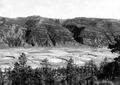 Animas Valley CO 1903
 -
Floodplain
-
Floodplain
-
Flooding of Pampanga River after Typhoon Quinta (Molave), Santa Rosa, Nueva Ecija


Medical Disclaimer: WikiMD is for informational purposes only and is not a substitute for professional medical advice. Content may be inaccurate or outdated and should not be used for diagnosis or treatment. Always consult your healthcare provider for medical decisions. Verify information with trusted sources such as CDC.gov and NIH.gov. By using this site, you agree that WikiMD is not liable for any outcomes related to its content. See full disclaimer.
Credits:Most images are courtesy of Wikimedia commons, and templates, categories Wikipedia, licensed under CC BY SA or similar.
Translate page: - East Asian
中文,
日本,
한국어,
South Asian
हिन्दी,
தமிழ்,
తెలుగు,
Urdu,
ಕನ್ನಡ,
Southeast Asian
Indonesian,
Vietnamese,
Thai,
မြန်မာဘာသာ,
বাংলা
European
español,
Deutsch,
français,
Greek,
português do Brasil,
polski,
română,
русский,
Nederlands,
norsk,
svenska,
suomi,
Italian
Middle Eastern & African
عربى,
Turkish,
Persian,
Hebrew,
Afrikaans,
isiZulu,
Kiswahili,
Other
Bulgarian,
Hungarian,
Czech,
Swedish,
മലയാളം,
मराठी,
ਪੰਜਾਬੀ,
ગુજરાતી,
Portuguese,
Ukrainian

.jpeg)
,_Santa_Rosa,_Nueva_Ecija.jpg)