Sabah: Difference between revisions
CSV import Tags: mobile edit mobile web edit |
CSV import |
||
| Line 24: | Line 24: | ||
{{stub}} | {{stub}} | ||
<gallery> | |||
File:Madai_Sabah_Madai-Cave-01.jpg|Madai Cave | |||
File:Concession_of_Sabah_(Brunei)_1877.jpg|Concession of Sabah (Brunei) 1877 | |||
File:Concession_of_Sabah_(Sulu)_1878.jpg|Concession of Sabah (Sulu) 1878 | |||
File:Japanese_civilians_and_soldiers,_Tawao_(AWM_121707).JPG|Japanese civilians and soldiers, Tawao | |||
File:Sabah_during_the_formation_of_Malaysia_(16_September_1963).jpg|Sabah during the formation of Malaysia (16 September 1963) | |||
File:KotaKinabalu_Sabah_Sabah-State-Administrative-Centre-02.jpg|Sabah State Administrative Centre | |||
File:KotaKinabalu_Sabah_DewanUndanganNegeriSabah-01.jpg|Dewan Undangan Negeri Sabah | |||
File:Penampang_Sabah_Musa-Aman-during-Kaamatan-2014-01.jpg|Musa Aman during Kaamatan 2014 | |||
File:Hajiji_Noor.png|Hajiji Noor | |||
File:Semporna_Sabah_ESSCOM-soldiers-04_(extracted).jpg|ESSCOM soldiers in Semporna | |||
File:Map_of_British_North_Borneo,_yellow_area_covered_by_the_Philippine_claim.PNG|Map of British North Borneo, yellow area covered by the Philippine claim | |||
</gallery> | |||
Latest revision as of 21:40, 23 February 2025
Sabah is a state of Malaysia located on the northern portion of Borneo. It has land borders with the Malaysian state of Sarawak to the southwest and Indonesia's Kalimantan region to the south. The Federal Territory of Labuan is an island just off the Sabah coast. Sabah shares maritime borders with Vietnam to the west and the Philippines to the north and east. Kota Kinabalu is the state capital city, the economic centre of the state, and the seat of the Sabah state government. Other major towns in Sabah include Sandakan and Tawau.
History[edit]
The history of Sabah can be traced back to about 23–30,000 years ago when evidence suggests the earliest human settlement in the region existed. The history is interwoven with the history of Brunei and Indonesia and the history of Malaysia, which Sabah became part of in 1963.
Geography[edit]
Sabah has an equatorial climate with tropical rainforests and abundant animal and plant species. The state has long mountain ranges on the west side which form part of the Crocker Range National Park. Kinabatangan River, the second longest river in Malaysia runs through Sabah and Mount Kinabalu is the highest point of Sabah as well as of Malaysia.
Economy[edit]
The economy of Sabah is mainly based on agriculture, forestry, and tourism. Sabah is also known for its natural resources, and the state's export commodities include oil, gas, timber and palm oil.
Culture[edit]
The people of Sabah are divided into 32 officially recognised ethnic groups. The largest non-Malaysian ethnic group in Sabah are the Bajau, and the largest Malaysian ethnic group is the Kadazan-Dusun.
See also[edit]
 | |
|---|---|
|
|
 |
-
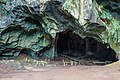 Madai Cave
 -
 Concession of Sabah (Brunei) 1877
 -
 Concession of Sabah (Sulu) 1878
 -
 Japanese civilians and soldiers, Tawao
 -
 Sabah during the formation of Malaysia (16 September 1963)
 -
 Sabah State Administrative Centre
 -
 Dewan Undangan Negeri Sabah
 -
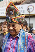 Musa Aman during Kaamatan 2014
 -
 Hajiji Noor
 -
 ESSCOM soldiers in Semporna
 -
 Map of British North Borneo, yellow area covered by the Philippine claim

_1877.jpg)
_1878.jpg)
.JPG)
.jpg)


.jpg)

