Remote sensing: Difference between revisions
CSV import Tags: mobile edit mobile web edit |
CSV import |
||
| Line 62: | Line 62: | ||
{{Environment-stub}} | {{Environment-stub}} | ||
{{Military-stub}} | {{Military-stub}} | ||
== Remote_sensing == | |||
<gallery> | |||
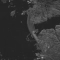
File:Death-valley-sar.jpg|Death valley sar | |||
File:Mapping_The_Future_With_Landsat.ogv|Mapping The Future With Landsat | |||
File:Remote_Sensing_Illustration.jpg|Remote Sensing Illustration | |||
File:25cm_radar_image_of_Aswan_Dam,_Egypt_from_Umbra_Lab_Inc.tif|25cm radar image of Aswan Dam, Egypt from Umbra Lab Inc | |||
File:Deployment_of_oceanographic_research_vessels.png|Deployment of oceanographic research vessels | |||
File:Usaf.u2.750pix.jpg|Usaf u2 750pix | |||
File:2001_mars_odyssey_wizja.jpg|2001 mars odyssey wizja | |||
</gallery> | |||
Latest revision as of 21:05, 23 February 2025
Remote sensing is the process of detecting and monitoring the physical characteristics of an area by measuring its reflected and emitted radiation at a distance (typically from satellite or aircraft). Special cameras collect remotely sensed images, which help researchers "sense" things about the Earth.
History[edit]
The concept of remote sensing originated in the mid-20th century with the development of photogrammetry. The technology evolved with the advent of aerial photography, satellite imaging, and radar and sonar systems.
Types of Remote Sensing[edit]
Remote sensing can be classified into two types: active and passive.
Active Remote Sensing[edit]
Active remote sensing involves the emission of radiation by the sensor itself and the measurement of the energy reflected back. Examples include Lidar and radar.
Passive Remote Sensing[edit]
Passive remote sensing involves the measurement of natural energy that is reflected or emitted from the observed scene. Examples include infrared, photographic, and radiometric sensors.
Applications[edit]
Remote sensing has a wide range of applications in many fields, including geography, geology, agriculture, environmental science, and military intelligence.
Geography[edit]
In geography, remote sensing is used to create detailed maps and to monitor changes in land use and land cover.
Geology[edit]
In geology, remote sensing can help identify different types of rocks and soils, and detect changes in the Earth's surface due to natural events such as earthquakes and landslides.
Agriculture[edit]
In agriculture, remote sensing is used to monitor crop growth, identify disease outbreaks, and assess drought conditions.
Environmental Science[edit]
In environmental science, remote sensing is used to monitor environmental changes, such as deforestation, desertification, and climate change.
Military Intelligence[edit]
In military intelligence, remote sensing is used for reconnaissance and surveillance, and to detect and monitor military activities.
See Also[edit]


This article is a agriculture stub. You can help WikiMD by expanding it!

This article is a environment-related stub. You can help WikiMD by expanding it!

Remote_sensing[edit]
-
 Death valley sar
 -
 Mapping The Future With Landsat
 -
 Remote Sensing Illustration
 -
 25cm radar image of Aswan Dam, Egypt from Umbra Lab Inc
 -
 Deployment of oceanographic research vessels
 -
 Usaf u2 750pix
 -
 2001 mars odyssey wizja


