File:Rigobert-Bonne-Atlas-de-toutes-les-parties-connues-du-globe-terrestre MG 0031.tif
From WikiMD's medical encyclopedia
Size of this preview of this TIF file: 800 × 408 pixels. Other resolutions: 320 × 163 pixels | 640 × 326 pixels | 1,024 × 522 pixels | 1,280 × 652 pixels | 3,597 × 1,833 pixels.
Original file (3,597 × 1,833 pixels, file size: 25.16 MB, MIME type: image/tiff)
Summary
| Description |
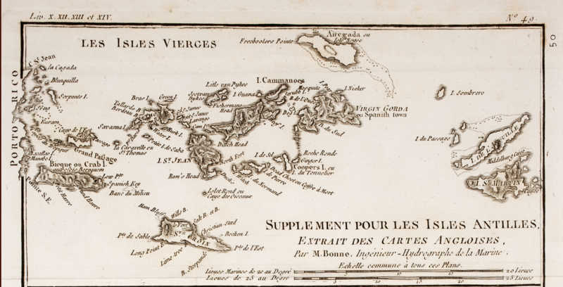
Français : .. English: Map of the Spanish Virgin Islands, the United States Virgin Islands, the British Virgin Islands, Antigua and Barbuda, Barbados, Saint Vincent and the Grenadines, Grenada, Dominica, (Saint-Christophe island:) Saint Kitts and Nevis. Nederlands: .. |
|||||||||||||||||||||||||||||||||||||||||
| Date | ||||||||||||||||||||||||||||||||||||||||||
| Source |
Atlas de toutes les parties connues du globe terrestre, dressé pour L'Histoire philosophique et politique des établissements et du commerce des Européens dans les deux Indes. 1780. Publisher:[Amsterdam]: [E. van Harrevelt]. Printer: Harrevelt, Evert van, Amsterdam, 1755-1781. Note: with 49 engraved maps and 22 tables. |
|||||||||||||||||||||||||||||||||||||||||
| Author |
|
|||||||||||||||||||||||||||||||||||||||||
| Permission (Reusing this file) |
|
|||||||||||||||||||||||||||||||||||||||||

File history
Click on a date/time to view the file as it appeared at that time.
| Date/Time | Thumbnail | Dimensions | User | Comment | |
|---|---|---|---|---|---|
| current | 02:17, 22 December 2022 |  | 3,597 × 1,833 (25.16 MB) | Uffda608 | Cropped to emphasize Virgin Islands |
File usage
The following page uses this file: