Map: Difference between revisions
CSV import Tags: mobile edit mobile web edit |
CSV import |
||
| Line 40: | Line 40: | ||
[[Category:Navigation]] | [[Category:Navigation]] | ||
{{Geography-stub}} | {{Geography-stub}} | ||
<gallery> | |||
File:Physical_World_Map.svg|Physical World Map | |||
File:World_Map_(political).svg|World Map (political) | |||
File:Engraving_on_a_mammoth_tusk,_map,_Gravettian,_076872x.jpg|Engraving on a mammoth tusk, map, Gravettian | |||
File:Tabula_Rogeriana_1929_copy_by_Konrad_Miller.jpg|Tabula Rogeriana 1929 copy by Konrad Miller | |||
File:Planisphæri_cœleste.jpg|Planisphæri cœleste | |||
File:Hereford-Karte.jpg|Hereford-Karte | |||
File:Atlas_de_Wit_1698-pl044-Utrecht-KB_PPN_145205088.jpg|Atlas de Wit 1698 pl044 Utrecht KB PPN 145205088 | |||
File:EU_Pop2008_1024.PNG|EU Pop2008 1024 | |||
File:Map_of_United_States_accessible_colors_shown.svg|Map of United States accessible colors shown | |||
File:Mid-ocean_ridge_system.gif|Mid-ocean ridge system | |||
File:The_geologic_map_of_the_Moon_at_1-2.5M_scale.png|The geologic map of the Moon at 1:2.5M scale | |||
File:Topographic_map_example.png|Topographic map example | |||
</gallery> | |||
Latest revision as of 21:37, 23 February 2025
Map is a symbolic representation of geographical features or relationships between different elements present in a space. Maps are used in various fields such as geography, cartography, and navigation. They serve as essential tools for understanding and navigating the physical world, as well as abstract concepts and relationships.
History of Maps[edit]
The history of maps dates back to ancient times. The earliest known maps are preserved on Babylonian clay tablets from about 2300 B.C. The Ancient Greeks and Romans made significant contributions to cartography, developing methods for accurately representing the Earth's surface on a map.
Types of Maps[edit]
There are several types of maps, each designed to serve a particular purpose. These include:
- Topographic maps: These maps show the physical features of a region, including mountains, rivers, and lakes. They also show man-made features such as roads and buildings.
- Political maps: These maps show political boundaries, such as countries, states, and cities. They often include significant infrastructure such as highways, airports, and capitals.
- Thematic maps: These maps focus on specific themes or topics, such as population density, climate, or economic activity.
- Physical maps: These maps show the physical landscape features of a place. They show physical features such as deserts, mountains and plains where broad areas of level land are.
Map Projections[edit]
A map projection is a method for representing the surface of a sphere or an ellipsoid on a plane. There are many different types of map projections, each with its own advantages and disadvantages. Some of the most common types include the Mercator projection, the Robinson projection, and the Mollweide projection.
[edit]
Map reading and navigation are essential skills for many outdoor activities, such as hiking, orienteering, and sailing. These skills involve understanding the symbols and scales used on maps, as well as techniques for determining one's position and planning a route.
See Also[edit]
References[edit]
<references />

-
 Physical World Map
 -
 World Map (political)
 -
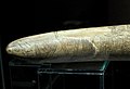 Engraving on a mammoth tusk, map, Gravettian
 -
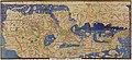 Tabula Rogeriana 1929 copy by Konrad Miller
 -
 Planisphæri cœleste
 -
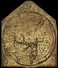 Hereford-Karte
 -
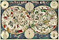
 Atlas de Wit 1698 pl044 Utrecht KB PPN 145205088
 -
 EU Pop2008 1024
 -
 Map of United States accessible colors shown
 -
 Mid-ocean ridge system
 -
 The geologic map of the Moon at 1:2.5M scale
 -
 Topographic map example

.svg)


