Interstate 64: Difference between revisions
CSV import |
CSV import |
||
| Line 50: | Line 50: | ||
{{US-road-stub}} | {{US-road-stub}} | ||
<gallery> | |||
File:I-64_US-40_Spoede_Road_2008.jpg|Interstate 64 at Spoede Road | |||
File:Poplar_Street_Bridge_KM.jpg|Poplar Street Bridge | |||
File:Sherman_Minton_Bridge_from_New_Albany_Indiana.jpg|Sherman Minton Bridge | |||
File:Interstate_64_nighttime.jpg|Interstate 64 at night | |||
File:WVtollbooth.jpg|West Virginia toll booth on Interstate 64 | |||
File:I-81_Exit_191_Sign_Bridge_original.jpg|Interstate 81 Exit 191 Sign Bridge | |||
File:Toisign1.png|Interstate 64 | |||
</gallery> | |||
Latest revision as of 11:16, 18 February 2025
Interstate 64
| Country | USA |
|---|---|
| State or province | |
| Type | I |
| Route number | 64 |
| Alternate name | |
| Maintained by | |
| Length | 953 miles ( km) |
| Established | 1956 |
| Decommissioned | |
| Status |
Interstate 64 (I-64) is a major east-west Interstate Highway in the Eastern United States. It extends from Wentzville, Missouri, a suburb of St. Louis, through six states to Chesapeake, Virginia, near the Atlantic Ocean. The highway serves major cities such as St. Louis, Louisville, Lexington, Charleston, and Richmond, facilitating both passenger and freight traffic in the central and eastern regions of the country.
Route description[edit]
Interstate 64 covers a total of 953 miles, making it one of the longer Interstate Highways in the eastern United States. The route begins in Wentzville, Missouri, and travels eastward, crossing the Mississippi River into Illinois shortly after passing through St. Louis. It continues through southern Illinois, entering Indiana, where it briefly passes through the state before entering Kentucky. In Kentucky, I-64 passes through Louisville and Lexington, major hubs for transportation and commerce.
After Kentucky, the highway crosses into West Virginia, traversing the Appalachian Mountains and providing scenic views of the mountainous terrain, particularly through the New River Gorge. Continuing east, I-64 enters Virginia, where it passes through the state capital, Richmond, and continues towards the Hampton Roads area, ending in Chesapeake, Virginia.
History[edit]
Construction of I-64 began in the 1950s, with the highway being designated as part of the original Interstate Highway System. The route was completed in sections, with the final segment being opened in the 1980s. Over the years, I-64 has undergone several expansion and improvement projects to accommodate increasing traffic and to maintain safety standards.
Major junctions[edit]
Interstate 64 intersects several major highways, facilitating regional connectivity. Notable junctions include:
- Interstate 70 in St. Louis, Missouri
- Interstate 65 and Interstate 71 in Louisville, Kentucky
- Interstate 75 in Lexington, Kentucky
- Interstate 77 in Charleston, West Virginia
- Interstate 95 in Richmond, Virginia
Future developments[edit]
Plans for upgrading and improving I-64 continue to be discussed, with proposals focusing on widening sections of the highway, improving interchanges, and enhancing safety features. These developments are aimed at addressing the growing traffic demands and improving the overall efficiency of the transportation network in the regions served by I-64.
See also[edit]
This United States road or road transport-related article is a stub. You can help Wikipedia by adding missing information. |
-
 Interstate 64 at Spoede Road
 -
 Poplar Street Bridge
 -
 Sherman Minton Bridge
 -
 Interstate 64 at night
 -
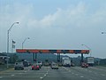 West Virginia toll booth on Interstate 64
 -
 Interstate 81 Exit 191 Sign Bridge
 -
 Interstate 64


