Van Nuys: Difference between revisions
CSV import Tags: mobile edit mobile web edit |
CSV import |
||
| (One intermediate revision by the same user not shown) | |||
| Line 1: | Line 1: | ||
'''Van Nuys''' is a neighborhood in the central | == Van Nuys == | ||
'''Van Nuys''' is a neighborhood in the central San Fernando Valley region of [[Los Angeles]], [[California]]. It was founded in 1911 and named after [[Isaac Newton Van Nuys]], one of its developers. Van Nuys is known for its diverse community and serves as a major commercial and governmental hub in the San Fernando Valley. | |||
== History == | == History == | ||
Van Nuys was established in 1911 as part of the expansion of the San Fernando Valley. The area was developed by the Los Angeles Suburban Homes Company, which included prominent figures such as [[Harrison Gray Otis]], [[Harry Chandler]], [[Moses Sherman]], and [[W. P. Whitsett]]. The neighborhood was named after Isaac Newton Van Nuys, a businessman and rancher who owned a large portion of the land. | |||
The arrival of the [[Pacific Electric Railway]] in 1911 spurred growth in the area, making it accessible to Los Angeles. Van Nuys was annexed by Los Angeles in 1915, which brought city services and infrastructure to the community. | |||
== Geography == | == Geography == | ||
Van Nuys is located in the central | Van Nuys is located in the central part of the San Fernando Valley, bordered by [[North Hills]] to the north, [[Panorama City]] to the northeast, [[Valley Glen]] to the east, [[Sherman Oaks]] to the south, and [[Lake Balboa]] to the west. The neighborhood is bisected by the [[Los Angeles River]] and is characterized by its flat terrain. | ||
== Demographics == | == Demographics == | ||
Van Nuys is one of the most diverse neighborhoods in Los Angeles, with a population that includes a mix of ethnicities and cultures. According to the 2010 U.S. Census, the population of Van Nuys was approximately 136,443. The area has a significant [[Latino]] population, along with communities of [[White]], [[Asian]], and [[African American]] residents. | |||
== Economy == | == Economy == | ||
Van Nuys | Van Nuys is a major commercial center in the San Fernando Valley, with a variety of businesses and industries. The neighborhood is home to the [[Van Nuys Airport]], one of the busiest general aviation airports in the world. The area also hosts numerous auto dealerships, retail stores, and service industries. | ||
== Government and Infrastructure == | |||
Van Nuys serves as a governmental hub for the San Fernando Valley. It houses the [[Van Nuys Government Center]], which includes the [[Los Angeles Superior Court]], the [[Van Nuys Police Station]], and various city offices. The neighborhood is also home to the [[Marvin Braude San Fernando Valley Constituent Service Center]]. | |||
== Education == | == Education == | ||
Van Nuys is served by the [[Los Angeles Unified School District]]. | Van Nuys is served by the [[Los Angeles Unified School District]]. Notable schools in the area include [[Van Nuys High School]], [[Columbus Avenue Elementary School]], and [[Van Nuys Middle School]]. The neighborhood also has several private and charter schools. | ||
== Transportation == | == Transportation == | ||
Van Nuys is | Van Nuys is well-connected by public transportation, with several [[Los Angeles Metro]] bus lines serving the area. The [[Orange Line]] busway provides rapid transit service across the San Fernando Valley. Major thoroughfares include [[Van Nuys Boulevard]], [[Sepulveda Boulevard]], and the [[San Diego Freeway]] (I-405). | ||
== | == Parks and Recreation == | ||
Van Nuys offers several parks and recreational facilities, including [[Woodley Park]], the [[Sepulveda Basin Recreation Area]], and the [[Van Nuys Recreation Center]]. These parks provide residents with opportunities for outdoor activities such as picnicking, sports, and walking. | |||
== | == Related Pages == | ||
* [[San Fernando Valley]] | * [[San Fernando Valley]] | ||
* [[Los Angeles]] | |||
* [[Van Nuys Airport]] | |||
== References == | |||
{{Reflist}} | |||
== Gallery == | |||
<gallery> | |||
File:W. P. Whitsett's real estate office (00049699).jpg|W. P. Whitsett's real estate office | |||
File:Old Van Nuys Post Office.jpg|Old Van Nuys Post Office | |||
File:Orange Line Bike Path, Van Nuys.jpg|Orange Line Bike Path | |||
File:Van Nuys, Southern California (6042688851).jpg|Van Nuys, Southern California | |||
File:SFValley.jpg|San Fernando Valley | |||
File:Woodley park picnic area.jpg|Woodley Park picnic area | |||
File:Van Nuys High School 2008.JPG|Van Nuys High School | |||
File:Columbus Ave. Elementary School, Van Nuys, CA.JPG|Columbus Avenue Elementary School | |||
File:Van Nuys Branch Library, Van Nuys.JPG|Van Nuys Branch Library | |||
File:Van Nuys Post Office 05.16.10 pic.JPG|Van Nuys Post Office | |||
File:Erwin St. Mall, Van Nuys.JPG|Erwin Street Mall | |||
File:Govt Center, Van Nuys Blvd. and Erwin.JPG|Government Center | |||
File:Marvin Braude SFV Constituent Svc Ctr.JPG|Marvin Braude SFV Constituent Service Center | |||
File:Van Nuys State Office Building.JPG|Van Nuys State Office Building | |||
File:LA Muni Court, Van Nuys Div.JPG|LA Municipal Court, Van Nuys Division | |||
File:Van Nuys Library (new).JPG|New Van Nuys Library | |||
File:Van Nuys Community Police Station, 6240 Sylmar Ave Mall.JPG|Van Nuys Community Police Station | |||
File:Van Nuys Civic Child Development Ctr.JPG|Van Nuys Civic Child Development Center | |||
File:Van Nuys Blvd and Delano.JPG|Van Nuys Boulevard and Delano | |||
File:Valley Presbyterian Hospital, Van Nuys, CA.JPG|Valley Presbyterian Hospital | |||
</gallery> | |||
[[Category:Neighborhoods in Los Angeles]] | [[Category:Neighborhoods in Los Angeles]] | ||
[[Category:San Fernando Valley]] | [[Category:San Fernando Valley]] | ||
<gallery> | |||
File:W._P._Whitsett's_real_estate_office_(00049699).jpg|Van Nuys | |||
File:Old_Van_Nuys_Post_Office.jpg|Van Nuys | |||
File:Orange_Line_Bike_Path,_Van_Nuys.jpg|Van Nuys | |||
File:Van_Nuys,_Southern_California_(6042688851).jpg|Van Nuys | |||
File:SFValley.jpg|Van Nuys | |||
File:Woodley_park_picnic_area.jpg|Van Nuys | |||
File:Van_Nuys_High_School_2008.JPG|Van Nuys | |||
File:Columbus_Ave._Elementary_School,_Van_Nuys,_CA.JPG|Van Nuys | |||
File:Van_Nuys_Branch_Library,_Van_Nuys.JPG|Van Nuys | |||
File:Van_Nuys_Post_Office_05.16.10_pic.JPG|Van Nuys | |||
File:Erwin_St._Mall,_Van_Nuys.JPG|Van Nuys | |||
File:Govt_Center,_Van_Nuys_Blvd._and_Erwin.JPG|Van Nuys | |||
</gallery> | |||
Latest revision as of 11:58, 18 February 2025
Van Nuys[edit]
Van Nuys is a neighborhood in the central San Fernando Valley region of Los Angeles, California. It was founded in 1911 and named after Isaac Newton Van Nuys, one of its developers. Van Nuys is known for its diverse community and serves as a major commercial and governmental hub in the San Fernando Valley.
History[edit]
Van Nuys was established in 1911 as part of the expansion of the San Fernando Valley. The area was developed by the Los Angeles Suburban Homes Company, which included prominent figures such as Harrison Gray Otis, Harry Chandler, Moses Sherman, and W. P. Whitsett. The neighborhood was named after Isaac Newton Van Nuys, a businessman and rancher who owned a large portion of the land.
The arrival of the Pacific Electric Railway in 1911 spurred growth in the area, making it accessible to Los Angeles. Van Nuys was annexed by Los Angeles in 1915, which brought city services and infrastructure to the community.
Geography[edit]
Van Nuys is located in the central part of the San Fernando Valley, bordered by North Hills to the north, Panorama City to the northeast, Valley Glen to the east, Sherman Oaks to the south, and Lake Balboa to the west. The neighborhood is bisected by the Los Angeles River and is characterized by its flat terrain.
Demographics[edit]
Van Nuys is one of the most diverse neighborhoods in Los Angeles, with a population that includes a mix of ethnicities and cultures. According to the 2010 U.S. Census, the population of Van Nuys was approximately 136,443. The area has a significant Latino population, along with communities of White, Asian, and African American residents.
Economy[edit]
Van Nuys is a major commercial center in the San Fernando Valley, with a variety of businesses and industries. The neighborhood is home to the Van Nuys Airport, one of the busiest general aviation airports in the world. The area also hosts numerous auto dealerships, retail stores, and service industries.
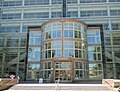
Government and Infrastructure[edit]
Van Nuys serves as a governmental hub for the San Fernando Valley. It houses the Van Nuys Government Center, which includes the Los Angeles Superior Court, the Van Nuys Police Station, and various city offices. The neighborhood is also home to the Marvin Braude San Fernando Valley Constituent Service Center.
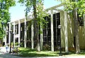
Education[edit]
Van Nuys is served by the Los Angeles Unified School District. Notable schools in the area include Van Nuys High School, Columbus Avenue Elementary School, and Van Nuys Middle School. The neighborhood also has several private and charter schools.
Transportation[edit]
Van Nuys is well-connected by public transportation, with several Los Angeles Metro bus lines serving the area. The Orange Line busway provides rapid transit service across the San Fernando Valley. Major thoroughfares include Van Nuys Boulevard, Sepulveda Boulevard, and the San Diego Freeway (I-405).
Parks and Recreation[edit]
Van Nuys offers several parks and recreational facilities, including Woodley Park, the Sepulveda Basin Recreation Area, and the Van Nuys Recreation Center. These parks provide residents with opportunities for outdoor activities such as picnicking, sports, and walking.
Related Pages[edit]
References[edit]
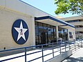
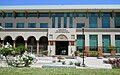
Gallery[edit]
-
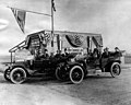 W. P. Whitsett's real estate office
 -
 Old Van Nuys Post Office
 -
 Orange Line Bike Path
 -
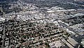 Van Nuys, Southern California
 -
 San Fernando Valley
 -
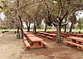 Woodley Park picnic area
 -
 Van Nuys High School
 -
 Columbus Avenue Elementary School
 -
 Van Nuys Branch Library
 -
 Van Nuys Post Office
 -
 Erwin Street Mall
 -
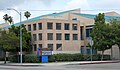
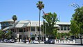 Government Center
 -
 Marvin Braude SFV Constituent Service Center
 -
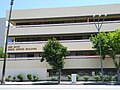 Van Nuys State Office Building
 -
 LA Municipal Court, Van Nuys Division
 -
 New Van Nuys Library
 -
 Van Nuys Community Police Station
 -
 Van Nuys Civic Child Development Center
 -
 Van Nuys Boulevard and Delano
 -
 Valley Presbyterian Hospital
.jpg)


.jpg)


.JPG)


-
Van Nuys
-
Van Nuys
-
Van Nuys
-
Van Nuys
-
Van Nuys
-
Van Nuys
-
Van Nuys
-
Van Nuys
-
Van Nuys
-
Van Nuys
-
Van Nuys
-
Van Nuys
