File:US insular areas SVG.svg

Original file (SVG file, nominally 2,754 × 1,398 pixels, file size: 1.08 MB)
Summary[edit]
| Summary | |
|---|---|
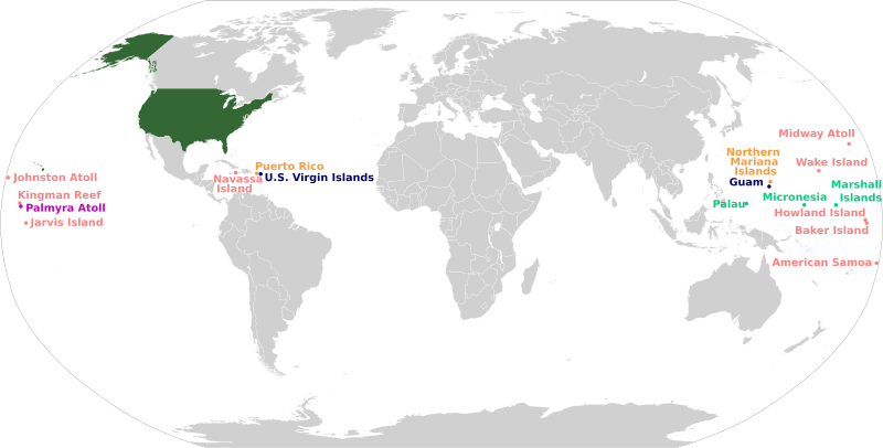
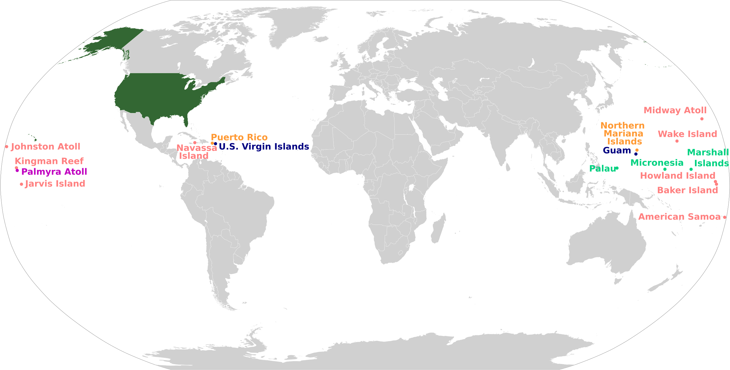
| Description | This is a map of the insular areas of the United States, plus the three sovereign countries in free association.
English (en): This map is color-coded according to each territory's status.
The 50 states and the District of Columbia Incorporated, unorganized territory Unincorporated territory with Commonwealth status Unincorporated, organized territory Unincorporated, unorganized territory Sovereign country with Compact of Free Association Version descriptions: Version 1: The first version of this map was based off File:BlankMap-World-v6.png by User:Astrokey44 with the locations of a few islands added; the source for this are two CIA maps; the maps are a map of the Pacific region and a map of the United States Pacific Island Wildlife Refuges. Hawaii has also been added to the map. Names of the islands are from the CIA Factbook. Version 2: The second version is based off File:Dependent territories 2007.png by User:Sesmith. Additional attribution includes User:Hoshie and User:KronosLine. Version 3: The third version incorporated all of the above in an SVG re-creation using File:OCDE World Map.svg by User:Mark Miller. Version 4 (Current): The current version incorporated all of the above in an SVG re-creation using File:BlankMap-World.svg by Pharexia. |
| Source | Wikimedia Commons file page |
| Author | Svenskbygderna (talk) (latest revision) |
| Permission | See original Commons license details. |
Licensing[edit]
Creative Commons Attribution-ShareAlike 3.0 Unported (CC BY-SA 3.0)
This file is licensed under the Creative Commons Attribution-ShareAlike 3.0 license.
Official license: CC BY-SA 3.0
License page: CC BY-SA 3.0
Original attribution and file history: Wikimedia Commons
File history
Click on a date/time to view the file as it appeared at that time.
| Date/Time | Thumbnail | Dimensions | User | Comment | |
|---|---|---|---|---|---|
| current | 03:33, 5 June 2026 | | 2,754 × 1,398 (1.08 MB) | Maintenance script (talk | contribs) | == Summary == Importing file |
You cannot overwrite this file.
File usage
The following file is a duplicate of this file (more details):
- File:US insular areas.svg from Wikimedia Commons
The following 2 pages use this file:
