File:Tegucigalpa location.png
From WikiMD's medical encyclopedia
No higher resolution available.
Tegucigalpa_location.png (249 × 153 pixels, file size: 18 KB, MIME type: image/png)
Summary
| Description | |
| Source | Wikipedia |
| Author | Wikipedia |
| Permission (Reusing this file) |
http://en.wikipedia.org/wiki/Tegucigalpa |
| This work has been released into the public domain by its author, Wikipedia. This applies worldwide. In some countries this may not be legally possible; if so: Wikipedia grants anyone the right to use this work for any purpose, without any conditions, unless such conditions are required by law.
|
Licensing
| This work is ineligible for copyright and therefore in the public domain because it consists entirely of information that is common property and contains no original authorship. |
File history
Click on a date/time to view the file as it appeared at that time.
| Date/Time | Thumbnail | Dimensions | User | Comment | |
|---|---|---|---|---|---|
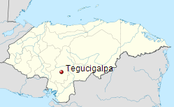
| current | 03:56, 18 October 2012 | | 249 × 153 (18 KB) | Dakin shaman | {{subst:Upload marker added by en.wp UW}} {{Information |Description = {{en|Geographical location of Tegucigalpa in Honduras.}} |Source = Wikipedia |Author = Wikipedia |Permission = http://en.wikipedia.org/wiki/Tegucigalpa }} {{PD-author|Wikipedia}} |
File usage
The following page uses this file: