File:Sri Lanka COVID-19 map of confirmed cases.svg
From WikiMD's medical encyclopedia

Size of this PNG preview of this SVG file: 393 × 599 pixels. Other resolutions: 157 × 240 pixels | 315 × 480 pixels | 393 × 600 pixels | 503 × 768 pixels | 671 × 1,024 pixels | 1,342 × 2,048 pixels | 512 × 781 pixels.
Original file (SVG file, nominally 512 × 781 pixels, file size: 77 KB)
Summary
| Description |
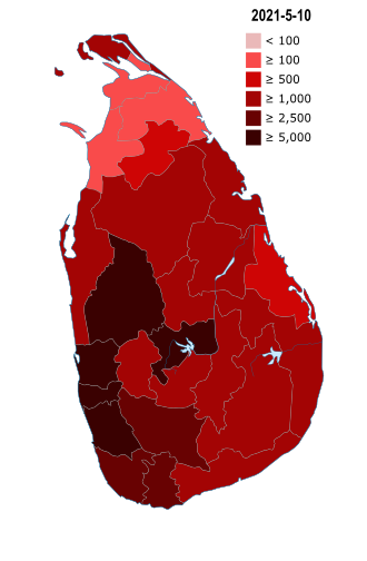
English: Map of districts and territories in the Sri Lanka with number of confirmed cases as of November 08, 2020 |
| Date | |
| Source | Own work |
| Author | Mithila Madawa Gunathilake |
| Permission (Reusing this file) |
I, the copyright holder of this work, hereby publish it under the following license: This file is licensed under the Creative Commons Attribution-Share Alike 4.0 International license.
|
| SVG development |
File history
Click on a date/time to view the file as it appeared at that time.
| Date/Time | Thumbnail | Dimensions | User | Comment | |
|---|---|---|---|---|---|
| current | 13:52, 10 May 2021 | | 512 × 781 (77 KB) | Mithila Madawa Gunathilake | Update |
File usage
The following 2 pages use this file: