File:Spb 06-2017 img01 Spit of Vasilievsky Island.jpg
From WikiMD's medical encyclopedia
Original file (4,258 × 2,839 pixels, file size: 4.93 MB, MIME type: image/jpeg)
Summary
| Description |
English: Aerial photo of the Vasilievsky Island Spit in Saint Petersburg, Russia.
Polski: Widok z lotu ptaka na wschodni cypel Wyspy Wasylewskiej (ros. Стрелка Васильевского острова) w Petersburgu, w Rosji.
Русский: Аэрофотосъёмка Стрелки Васильевского острова в Санкт-Петербурге, Россия.
Nederlands: Het Vasiljevski-eiland in de Russische stad Sint-Petersburg
|
| Date | |
| Source | Own work |
| Author | A.Savin |
| Permission (Reusing this file) |
Free Art License. Correct attribution is «A.Savin, Wikipedia». Free usage of the photo, no need to ask for approval. Лицензия Свободное искусство. Корректное указание авторства — «А.Савин, Википедия». Использование фотографии бесплатно, согласование не требуется. Lizenz Freie Kunst. Korrekte Autorenkennzeichnung ist «A.Savin, Wikipedia». Nutzung des Fotos kostenlos, Anfrage nicht erforderlich. |
| Camera location | | View this and other nearby images on: OpenStreetMap |
|---|
|
This image was selected as picture of the day on Wikimedia Commons for 8 February 2019. It was captioned as follows: Other languages:
Nederlands: Het Vasiljevski-eiland in de Russische stad Sint-Petersburg Polski: Widok z lotu ptaka na wschodni cypel Wyspy Wasylewskiej (ros. Стрелка Васильевского острова) w Petersburgu, w Rosji. |
| Annotations | This image is annotated: View the annotations at Commons |


Licensing
Copyleft: This work of art is free; you can redistribute it and/or modify it according to terms of the Free Art License. You will find a specimen of this license on the Copyleft Attitude site as well as on other sites.
|
File history
Click on a date/time to view the file as it appeared at that time.
| Date/Time | Thumbnail | Dimensions | User | Comment | |
|---|---|---|---|---|---|
| current | 00:45, 12 August 2017 | 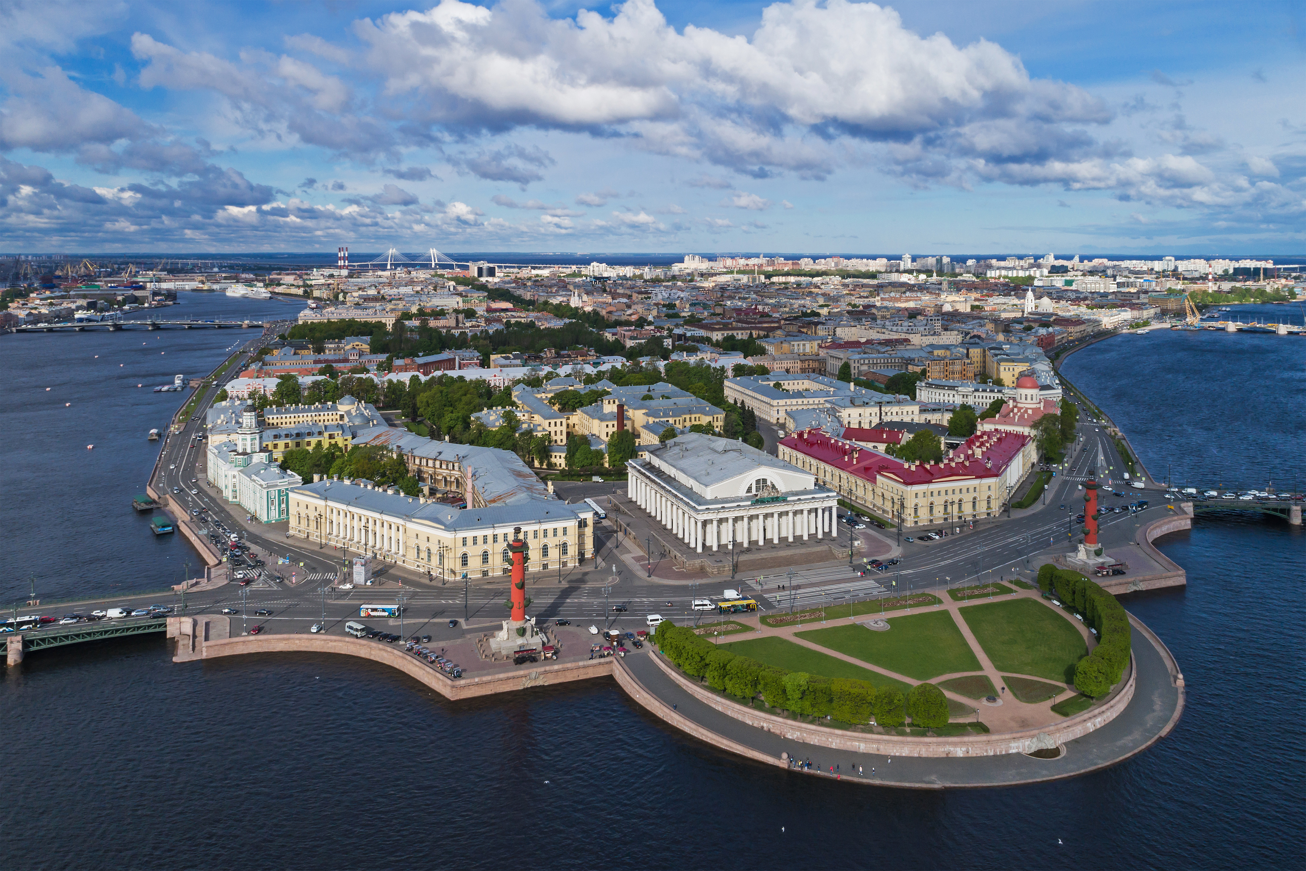 | 4,258 × 2,839 (4.93 MB) | A.Savin | {{User:A.Savin/F |Description= {{en|Aerial photo of the Vasilievsky Island Spit in Saint Petersburg (Russia).}} {{ru|Аэрофотосъёмка Стрелки Васильевского острова в Санкт-Петербурге (Россия)... |
File usage
The following page uses this file: