File:SarajevoSiege2.JPG

From WikiMD's medical encyclopedia
Original file(480 × 640 pixels, file size: 41 KB, MIME type: image/jpeg)

This file is from Wikimedia Commons and may be used by other projects. The description on its file description page there is shown below.

Summary

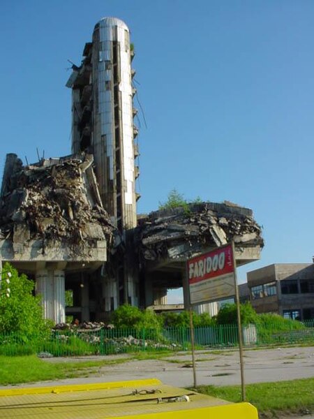
Description Destroyed Oslobodjenje building
Source Own work
Author fr:User:KimPhilby
Camera location43° 50′ 38.14″ N, 18° 20′ 06.89″ E  Heading=157.5° Kartographer map based on OpenStreetMap.View this and other nearby images on: OpenStreetMapinfo

Licensing

Public domain I, the copyright holder of this work, release this work into the public domain. This applies worldwide.
In some countries this may not be legally possible; if so:
I grant anyone the right to use this work for any purpose, without any conditions, unless such conditions are required by law.

Captions

Add a one-line explanation of what this file represents

Items portrayed in this file

depicts

43°50'38.141"N, 18°20'6.889"E

heading: 157.5 degree

image/jpeg

42,041 byte

640 pixel

480 pixel

288ffa5e0197c0e980a53a0c828902965168588f

File history

Click on a date/time to view the file as it appeared at that time.

Date/TimeThumbnailDimensionsUserComment
current13:41, 26 March 2006Thumbnail for version as of 13:41, 26 March 2006480 × 640 (41 KB)MaksimLa bildo estas kopiita de wikipedia:en. La originala priskribo estas: Picture obtained from French Wikipedia. Taken by User:KimPhilby and released into the public domain. {{PD-self}} fr:Image:Sarajevo-ancien-batiment-presse.jpg {| border="1" ! date/

The following page uses this file: