File:Map Gallia Tribes Towns-la.svg
From WikiMD's medical encyclopedia

Size of this PNG preview of this SVG file: 595 × 599 pixels. Other resolutions: 238 × 240 pixels | 477 × 480 pixels | 596 × 600 pixels | 763 × 768 pixels | 1,017 × 1,024 pixels | 2,034 × 2,048 pixels | 1,450 × 1,460 pixels.
Original file (SVG file, nominally 1,450 × 1,460 pixels, file size: 2.33 MB)
Summary
| Description |
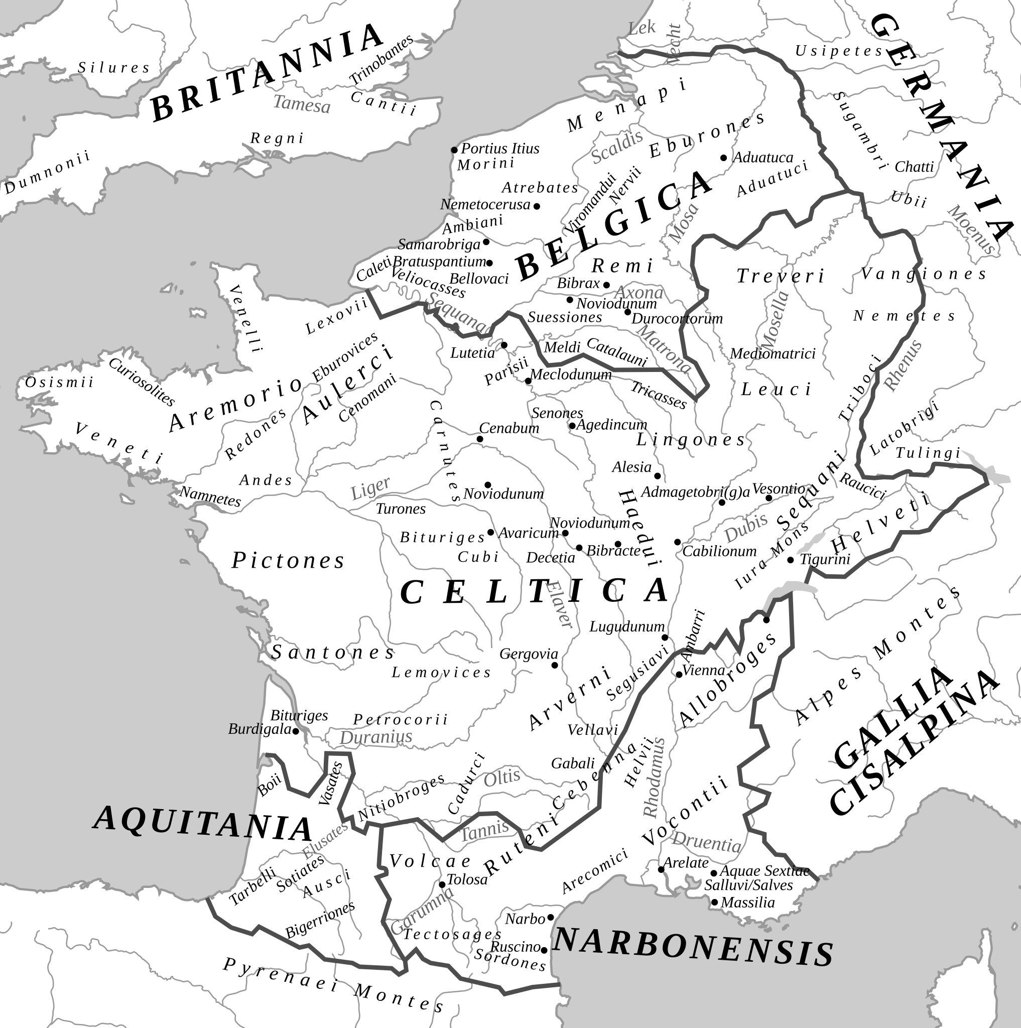
Afrikaans: Romeinse provinsies en stamgroepe van die Galliese gebied in die laat 1ste eeu v.C.
Ελληνικά: Χάρτης της Γαλατίας και των κελτικών φυλών τον 1ο αιώνα π.Χ.
English: Roman provinces and the Proto-basque, Celtic and Germanic peoples at the end of the 1st century BC. J-C.
Français : Provinces romaines et les peuples proto-basques, celtes et germanique à la fin du Ier siècle av. J-C. |
| Date | |
| Source |
|
| Author | Feitscherg |

Licensing
Feitscherg, the copyright holder of this work, hereby publishes it under the following license:

|
Permission is granted to copy, distribute and/or modify this document under the terms of the GNU Free Documentation License, Version 1.2 or any later version published by the Free Software Foundation; with no Invariant Sections, no Front-Cover Texts, and no Back-Cover Texts. A copy of the license is included in the section entitled GNU Free Documentation License. |
| This file is licensed under the Creative Commons Attribution-Share Alike 3.0 Unported license. | ||
Attribution:
| ||
| ||
| This licensing tag was added to this file as part of the GFDL licensing update. |
File history
Click on a date/time to view the file as it appeared at that time.
| Date/Time | Thumbnail | Dimensions | User | Comment | |
|---|---|---|---|---|---|
| current | 10:39, 2 September 2019 | | 1,450 × 1,460 (2.33 MB) | Rowanwindwhistler | Uploading a file from a free published source using File Upload Wizard |