File:Doggerland.svg
From WikiMD's medical encyclopedia

Size of this PNG preview of this SVG file: 545 × 600 pixels. Other resolutions: 436 × 480 pixels | 1,860 × 2,048 pixels.
Original file (SVG file, nominally 545 × 600 pixels, file size: 165 KB)
Summary
| Description |
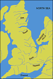
English: A map of the area known as Doggerland which connected the British Isles and the European continent. Loosely based on two images, found at http://www.bevpease.force9.co.uk/p.Flood_files/image002.jpg and http://humanities.exeter.ac.uk/archaeology/research/projects/title_89282_en.html, (now archived at https://web.archive.org/web/20220420042919/http://humanities.exeter.ac.uk/archaeology/research/projects/title_89282_en.html) however drawing work was all done in Illustrator by myself. Norway has been excluded from the map.
Deutsch: Paläogeografische Darstellung der Nordsee vor etwa 9000 Jahren, bevor Doggerland vom Festland getrennt wurde.
|
| SVG development | |
| Date | |
| Source | Own work based on: image002.jpg (JPEG, 203 × 300 Pixel). bevpease.force9.co.uk. Retrieved on 2025-11-03. and Bryony Coles. Research projects - The Doggerland project - Archaeology - University of Exeter. humanities.exeter.ac.uk. Archived from the original on 2022-04-20. Retrieved on 2022-04-20. |
| Creator | |
| Geotemporal data | |
| Heading |
 |
| Georeferencing | If inappropriate please set warp_status = skip to hide. |
Licensing
Max Naylor, the copyright holder of this work, hereby publishes it under the following licenses:
This file is licensed under the Creative Commons Attribution-Share Alike 3.0 Unported license.
Attribution:
- You are free:
- to share – to copy, distribute and transmit the work
- to remix – to adapt the work
- Under the following conditions:
- attribution – You must give appropriate credit, provide a link to the license, and indicate if changes were made. You may do so in any reasonable manner, but not in any way that suggests the licensor endorses you or your use.
- share alike – If you remix, transform, or build upon the material, you must distribute your contributions under the same or compatible license as the original.

|
Permission is granted to copy, distribute and/or modify this document under the terms of the GNU Free Documentation License, Version 1.2 or any later version published by the Free Software Foundation; with no Invariant Sections, no Front-Cover Texts, and no Back-Cover Texts. A copy of the license is included in the section entitled GNU Free Documentation License. |
You may select the license of your choice.
File history
Click on a date/time to view the file as it appeared at that time.
| Date/Time | Thumbnail | Dimensions | User | Comment | |
|---|---|---|---|---|---|
| current | 18:59, 19 October 2014 | | 545 × 600 (165 KB) | Ras67 | frame removed |