File:Cedid Atlas (Middle East) 1803.jpg
From WikiMD's medical encyclopedia

Size of this preview: 793 × 600 pixels. Other resolutions: 317 × 240 pixels | 635 × 480 pixels | 1,016 × 768 pixels | 1,280 × 968 pixels | 2,560 × 1,936 pixels | 10,840 × 8,199 pixels.
Original file (10,840 × 8,199 pixels, file size: 18.62 MB, MIME type: image/jpeg)
Summary
| Warning | The original file is very high-resolution. It might not load properly or could cause your browser to freeze when opened at full size. |
|---|
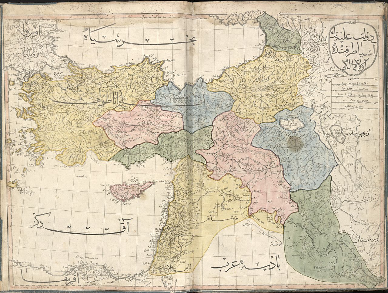
| Description |
العربية: خارطة عُثمانيَّة تُظهر الإيالات الشرقيَّة لِلدولة العُثمانيَّة سنة 1803م. الخارطة مأخوذة من الأطلس الجديد (وهي واحدة من أصل 24 ورقة). هذا الأطلس هو أوَّل أطلسٍ جُغرافي يُطبع في العالم الإسلامي، ولم يُطبع منه سوى 50 نسخة، وبهذا فهو يُعتبر أحد أندر الأطالس الجُغرافيَّة ذات القيمة التاريخيَّة على المُستويين العالمي والشرق أوسطي.
English: The Middle East sheet of the 1803 Cedid Atlas (one of 24 sheets in total). It is the first published atlas in the Muslim world, and only 50 copies were printed at the press, as such it is one of the rarest printed atlases of historical value and of great importance to Middle Eastern history. The current map is from page 61. |
||
| Date | |||
| Source |
|
||
| Creator |
Ottoman Empire |
||
| Georeferencing | If inappropriate please set warp_status = skip to hide. | ||
| Other versions |

_1803.jpg)

_1803.jpg)
_1803.jpg&flash=no)
|
_1803.jpg)
_1803.jpg)
Licensing
This media file is in the public domain in the United States. This applies to U.S. works where the copyright has expired, often because its first publication occurred prior to January 1, 1930, and if not then due to lack of notice or renewal. See this page for further explanation.
|
 | |
 |
File history
Click on a date/time to view the file as it appeared at that time.
| Date/Time | Thumbnail | Dimensions | User | Comment | |
|---|---|---|---|---|---|
| current | 18:35, 9 May 2015 | | 10,840 × 8,199 (18.62 MB) | Onceinawhile | User created page with UploadWizard |
File usage
The following page uses this file:
_1803.jpg)
_1803.jpg&mobileaction=toggle_view_mobile)