File:Carte de l'Ile de France.svg
From WikiMD's medical encyclopedia

Size of this PNG preview of this SVG file: 647 × 600 pixels. Other resolutions: 259 × 240 pixels | 518 × 480 pixels | 828 × 768 pixels | 1,104 × 1,024 pixels | 2,209 × 2,048 pixels | 2,627 × 2,436 pixels.
Original file (SVG file, nominally 2,627 × 2,436 pixels, file size: 1.48 MB)
Summary
| Description |
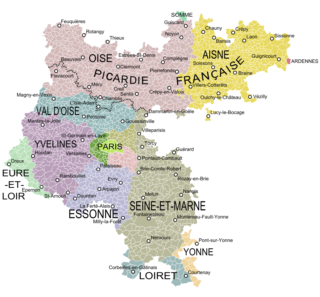
English: Map of the old military government of Ile de France, France, showing the communes according to the current administrative division. Français : Carte de l'ancien gouvernement militaire de l'Ile de France montrant les communes et les départements actuels. |
| Date | |
| Source |
|
| Author | Oie blanche, Vaulxnoy |
Licensing
I, the copyright holder of this work, hereby publish it under the following license:
This file is licensed under the Creative Commons Attribution-Share Alike 3.0 Unported license.
- You are free:
- to share – to copy, distribute and transmit the work
- to remix – to adapt the work
- Under the following conditions:
- attribution – You must give appropriate credit, provide a link to the license, and indicate if changes were made. You may do so in any reasonable manner, but not in any way that suggests the licensor endorses you or your use.
- share alike – If you remix, transform, or build upon the material, you must distribute your contributions under the same or compatible license as the original.
File history
Click on a date/time to view the file as it appeared at that time.
| Date/Time | Thumbnail | Dimensions | User | Comment | |
|---|---|---|---|---|---|
| current | 08:46, 28 April 2024 | | 2,627 × 2,436 (1.48 MB) | Vaulxnoy | Reverted to version as of 17:24, 27 April 2024 (UTC) L'expression Picardie française est utilisée par certains cartographes pour désigner la partie du Gouvernement militaire de l'IDF ne se confondant pas dans la province. C'est une nuance qu'il est raisonnable de préciser ici. Retour à la version précédente. |
File usage
The following page uses this file: